Page 2 of 2
Posted: 2008-07-21 09:03am
by PeZook
Posted: 2008-07-23 06:49am
by Bluewolf
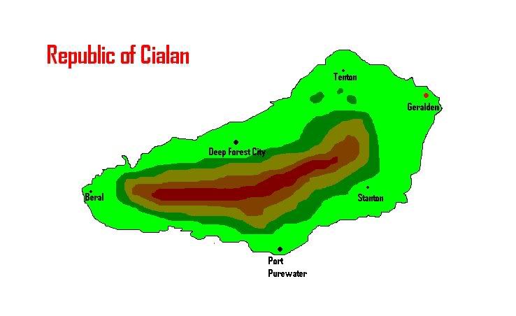
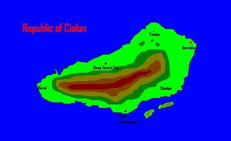
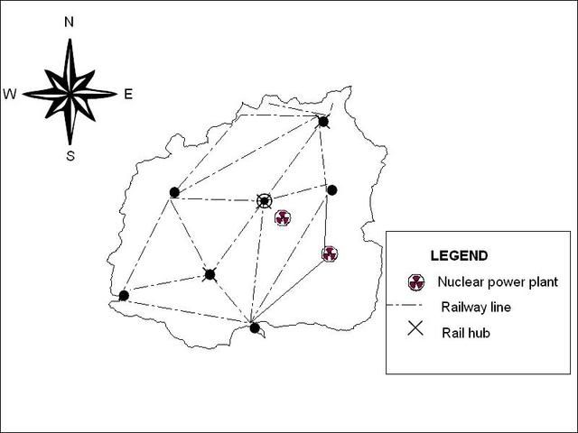
Ok, this is the basic map which I will work on more soon:
Just wanted to know if that was ok in size and shape.
Posted: 2008-07-23 06:51am
by PeZook
Size would kinda depend on scale

Posted: 2008-07-23 08:54am
by Bluewolf
It should be able to be the same size of an average Dutchy nation or have the dimensions changed for them?
Posted: 2008-07-23 09:13am
by Siege
Bluewolf wrote:It should be able to be the same size of an average Dutchy nation or have the dimensions changed for them?
There really isn't much of an 'average size' for Duchies as far as I'm aware. For example, I'm going with a very small but very densely populated city-state comparable to Singapore, whereas somebody else might prefer their place like Sweden: lots of land, sparsely populated.
Posted: 2008-07-23 05:02pm
by Bluewolf
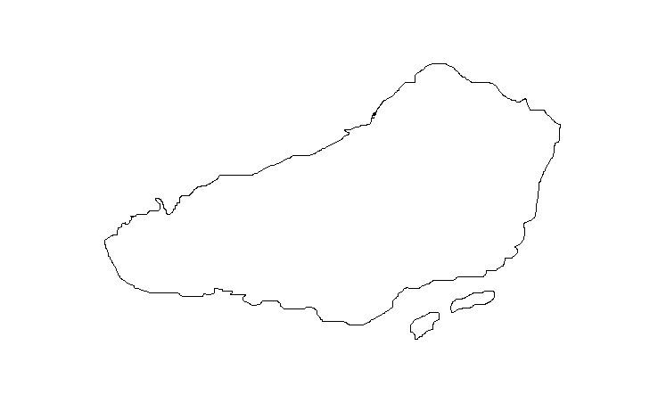
Ok, I have done my basic maps. I don't mind being part of a continent as long as I am on the coast but I also do not mind being an island (near a continent).
Land:
Island:
Posted: 2008-07-23 11:21pm
by Setzer
Here's an updated version of my own map:

Posted: 2008-07-27 08:23pm
by Raj Ahten
I now have a map for Indhopal. Behold:

Posted: 2008-08-01 03:22pm
by Karmic Knight
Far away from anything that resembles civilization and on the same Continent as Coiler and SiegeTank is all I ask.
Posted: 2008-08-02 09:21pm
by Pollux
I present to you a preliminary map of the United Republics of Anticlere and Cybiades, showing its political divisions.
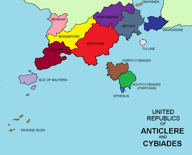
It's on the southern coast of the Old Continent with Shroomania, PeZookia, and Byzantium, among others.
Posted: 2008-08-02 09:34pm
by Mr Bean
I present my ultra-high resoultion photo of Khitan (Kith-tan)

Posted: 2008-08-04 11:46pm
by Vohu Manah
My preferred territorial map (yes, it is an island):

EDIT: I am open to developing a landlocked nation concept and will provide a map only upon request.
Posted: 2008-08-06 12:31am
by Steve
My map is a bit sucky, but I trust in Stas' skills.

Posted: 2008-08-09 05:37am
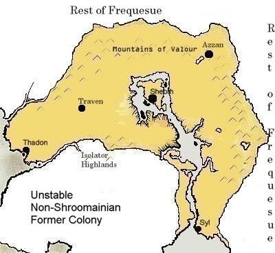
by Siege
The Corporate Republic of San Dorado:

I: San Dorado
II: La Palma
III: Port Regal
For the record, the map of the continent of Frequesue:

Posted: 2008-08-21 05:29pm
by RogueIce
The
good enough version of the "Fourth Continent"
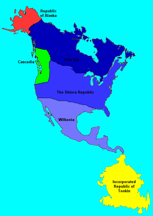
Yes, that is a waterway between Wilkonia and Tonkin.
Posted: 2008-08-21 06:30pm
by MKSheppard
Posted: 2008-08-21 07:31pm
by Lonestar
I approve of this map.

Posted: 2008-08-21 07:43pm
by Steve
I'll make an internal map of Cascadia in due time.
Posted: 2008-08-21 08:10pm
by Bluewolf
Ok, I would like to be near a continent if that is ok.
Posted: 2008-08-21 08:24pm
by Sea Skimmer
Posted: 2008-08-24 05:17pm
by Shinn Langley Soryu
Basic map of the Duchy of Langley (no cities, landmarks, or other labels):
http://img183.imageshack.us/img183/5954 ... yv2xh3.png
Posted: 2008-08-24 05:31pm
by Shroom Man 777
Haha! Inverted Philippines! (Without dengue-infested Palawan)

(I find it amusing as I am a Filipini. Pay me no heed.)
